
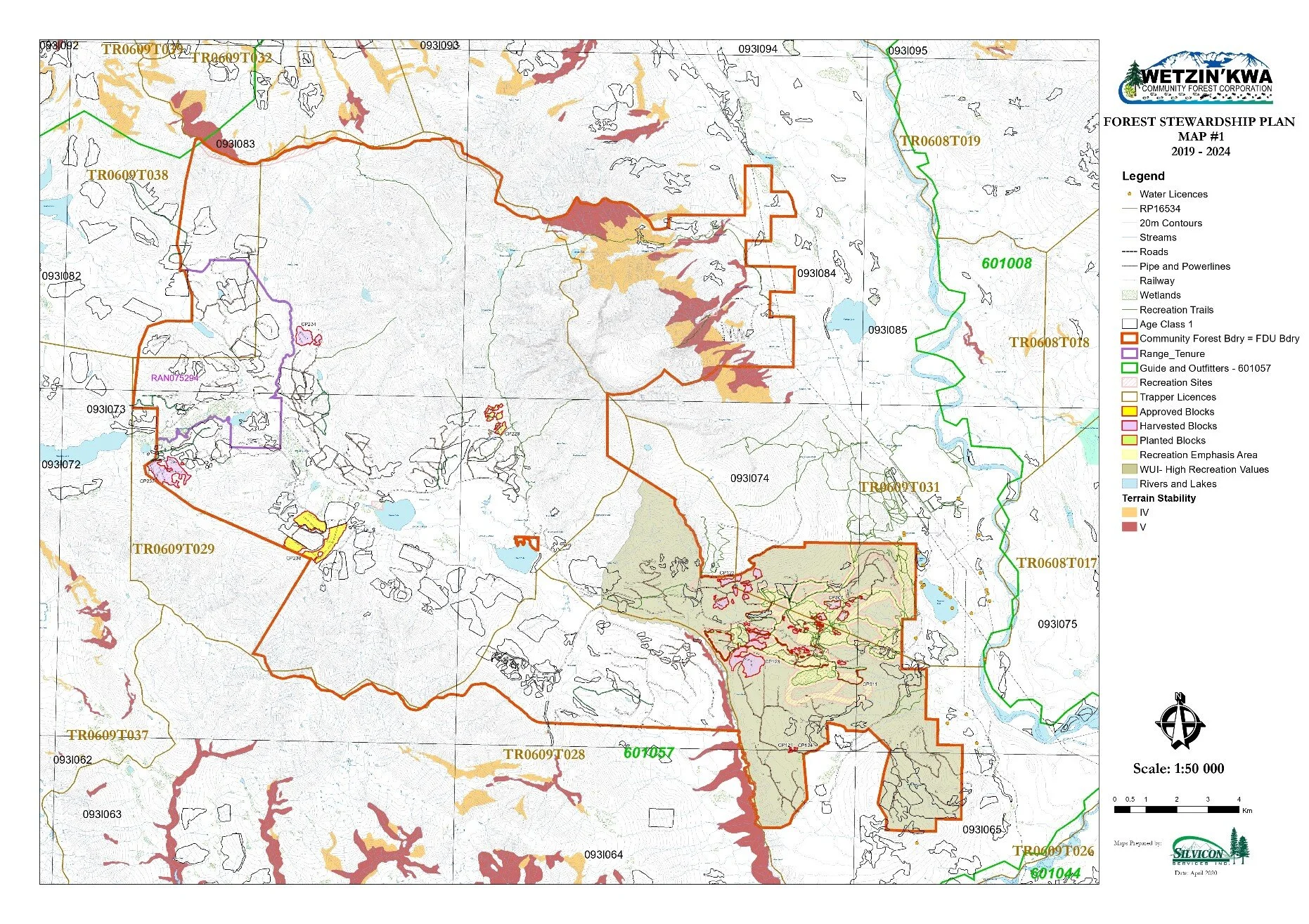
Wetzin’kwa Maps
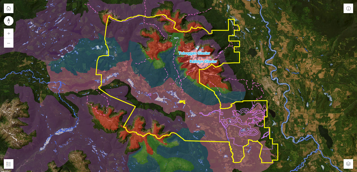
Wetzin’kwa Webmap
Explore the Community Forest with this interactive webmap that shows elements such as proposed and harvested blocks, roads, water and wildlife features, and trails and recreation areas.
GeoReferenced Wetzin’kwa Recreational Maps

Area Overview Map
Formatted for the Avenza Maps app (iOS, Android), formatted for home printers on 8.5x11” paper.
GeoReferenced Wetzin’kwa Recreational Maps

Hankin-Passby Map
Formatted for the Avenza Maps app (iOS, Android), formatted for home printers on 8.5x11” paper.
GeoReferenced Wetzin’kwa Recreational Maps

Formatted for the Avenza Maps app (iOS, Android), formatted for home printers on 8.5x11” paper.
McDonnell Map
GeoReferenced Wetzin’kwa Recreational Maps
Nordic-Ptarmigan Map
Formatted for the Avenza Maps app (iOS, Android), formatted for home printers on 8.5x11” paper.
GeoReferenced Wetzin’kwa Recreational Maps
Silvern Map
Formatted for the Avenza Maps app (iOS, Android), formatted for home printers on 8.5x11” paper.
Printable Wetzin’kwa Map
Formatted for home printers on 8.5x11” paper.
Ink saving version
Google Earth .kmz

Outline of the community forest, etc.
Community Forest trails map courtesy of the BV Backpackers, georeferenced for Avenza PDFs app.
Visit BVbackpackers.ca for more local maps and information.
